UPDATE 6/19/2025 @ 4:36 P.M.: A severe thunderstorm was located over Quantico, moving east at 50 mph.
A Severe Thunderstorm Warning has been placed for Charles, Northern St. Mary’s, Northern Calvert, Southern Prince Georges, and southern Anne Arundel Counties until 5:30 p.m.
IMPACT…Damaging winds will cause some trees and large branches to fall. This could injure those outdoors, as well as
damage homes and vehicles. Roadways may become blocked by downed trees. Localized power outages are possible. Unsecured light objects may become projectiles.
* Locations impacted include…
Stafford, Waldorf, Clinton, Fort Washington, Fort Hunt, La Plata, Fort Belvoir, Shady Side, Chesapeake Beach, Deale, Woodbridge, Prince Frederick, Quantico, Hallowing Point, Aquia Creek, Breezy Point, Sheridan Point, Port Tobacco River, Lake Ridge, and Lorton. Northern St. Mary’s County
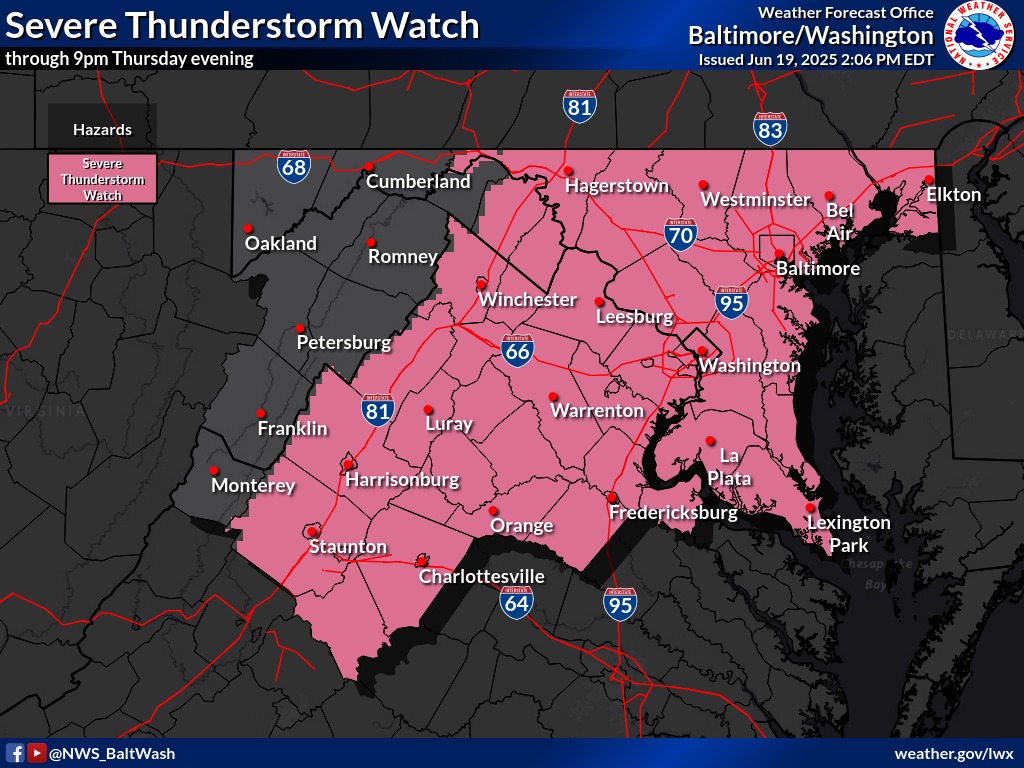
The National Weather Service has placed a Severe Thunderstorm Watch for Anne Arundel, Baltimore, Calvert, Caroline, Carroll, Cecil, Charles, Dorchester, Frederick, Harford, Howard, Kent, Montgomery, Prince Georges, Queen Anne’s, St. Marys, Somerset, Talbot, Washington, Wicomico and Baltimore City in MD until 9:00pm.
Today and tonight
Scattered to numerous severe thunderstorms capable of producing damaging wind gusts are possible this afternoon and evening. There is the potential for considerable storm damage from 70 mph gusts.
Large hail and an isolated tornado or two are also possible.
DAYS TWO THROUGH SEVEN…Friday through Wednesday
An extended period of excessively hot and humid conditions is expected Sunday through at least the middle of next week. Daily heat indices in the afternoon and evening of 100 to 110 are expected, and up to 115 degrees is possible.

