 The National Weather Service Baltimore MD/Washington DC has issued a Flood Watch, a Heat Advisory, and Hazardous Weather Outlook for Southern Maryland, including St. Mary’s, Calvert, Charles Counties.
The Flood Watch is in effect from 2:00 PM EDT this afternoon, Tuesday, July 8th, 2025, through this evening.
IMPACTS can include – Excessive runoff may result in flooding of rivers, creeks, streams, and other low-lying and flood-prone locations. Flooding may occur in poor drainage and urban areas.
* ADDITIONAL DETAILS – Numerous showers and thunderstorms will move across the area
this afternoon and evening. Rainfall rates of up to 2 inches per hour are possible, which may lead to scattered instances of flash flooding where the heavy rain persists the longest.
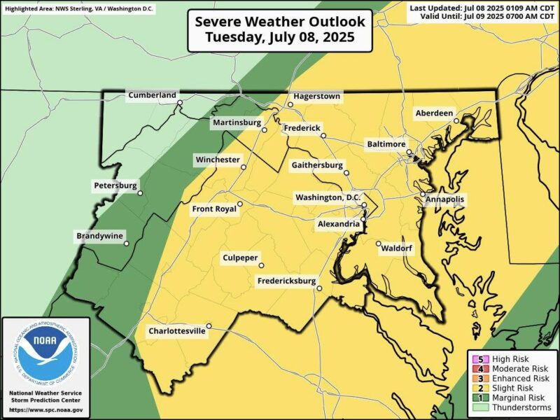
Our Weather outlook for the rest of this week include chances of severe storms and high heat indexes.
Due to forecasted high temperatures the Department of Public Safety has issued an animal safety alert from through Tuesday, July 8.
During this period, animal owners or custodians are required to provide appropriate protection from the weather, including adequate shelter, water, space and access to shade.
Today – Sunny, with a high near 95. Heat index values as high as 109. Southwest wind 6 to 9 mph becoming south in the afternoon.
Tonight – Showers and thunderstorms likely, mainly between 8pm and 9pm. Some of the storms could produce heavy rainfall. Mostly cloudy, with a low around 75. Northwest wind around 6 mph becoming northeast in the evening. Chance of precipitation is 70%. New rainfall amounts between a quarter and half of an inch possible.
Wednesday – A slight chance of showers and thunderstorms before 2pm, then showers likely and possibly a thunderstorm between 2pm and 5pm, then showers and thunderstorms likely after 5pm. Partly sunny, with a high near 92. Heat index values as high as 100. South wind around 6 mph. Chance of precipitation is 70%. New rainfall amounts between a quarter and half of an inch possible.
Wednesday Night – Showers and thunderstorms likely before 8pm, then showers likely and possibly a thunderstorm between 8pm and 2am, then a chance of showers and thunderstorms after 2am. Mostly cloudy, with a low around 74. South wind around 6 mph. Chance of precipitation is 70%. New rainfall amounts between three quarters and one inch possible.
Thursday – A chance of showers and thunderstorms, then showers and possibly a thunderstorm after 2pm. High near 89. Southwest wind around 8 mph. Chance of precipitation is 80%.
Thursday Night – Showers and possibly a thunderstorm, mainly before 2am, then a chance of showers and thunderstorms after 2am. Low around 74. Chance of precipitation is 80%.
Friday – A chance of showers, with thunderstorms also possible after 2pm. Mostly cloudy, with a high near 89. Chance of precipitation is 50%.
Friday Night – A chance of showers and thunderstorms before 2am. Mostly cloudy, with a low around 75. Chance of precipitation is 30%.


