 Governor Wes Moore declared a State of Preparedness ahead of significant risk for widespread, severe storms producing damaging winds, hail, and a heightened tornado threat across all of Maryland for Monday, March 16.
These storms have the potential to cause damages to structures, downed trees and powerlines, and create debris. Marylanders are urged to have a plan to shelter if a tornado or severe thunderstorm warning is issued for the area, secure or bring in loose objects around their homes, reschedule outdoor activities, and to follow local forecasts for the most up-to-date information for your area.
“In declaring a State of Preparedness for Maryland, I am directing the Department of Emergency Management to coordinate readiness efforts across state government in advance of the incoming severe storms,” said Gov. Moore. “The safety of Maryland families comes first. I am urging residents to prepare early, stay informed, and adjust plans, including postponing travel, as conditions change. Know the safest room at home or at work, and plan to be indoors before the storm arrives.”
A State of Preparedness enhances the State’s ability to respond swiftly and effectively to potential hazards and threats before escalating response, providing an easier path for information sharing and coordination. Multiple State agencies and departments including emergency management, transportation, law enforcement, and public health are coordinating to prepare for the storm. The Department of Emergency Management will be activating the State Emergency Operations Center to respond to the storm and is closely monitoring as it approaches the state.
“We are working with our state and local partners to prepare for potential impacts across Maryland,” said Maryland Department of Emergency Management Secretary Russ Strickland. “We are planning for the possibility of hazardous conditions which could include debris, downed powerlines, and travel disruptions. Marylanders should make their preparations now by reviewing family emergency plans including where to shelter during a tornado warning, charging personal devices in case of power outages, and signing up for local emergency alerts to stay informed. If you don’t need to be on the roads, stay home, and always follow guidance from local officials.”
Marylanders should prepare for high winds and severe storm conditions as this dangerous storm moves through the state on Monday, beginning mid-morning in Western Maryland and moving east across the state for much of the day and into the evening. At a minimum, most residents can expect delays and hazardous driving conditions during and after the storm, with potential damage to life and property while the storm is at its peak. Winds may create dangerous debris and cause power outages. According to the National Weather Service, the weather system is expected to significantly impact the region beginning Monday mid-morning to evening, bringing multiple threats that require heightened awareness and preparedness from Marylanders and those visiting our State.
Marylanders can expect the following during this weather event:
- A powerful cold front will bring a line of thunderstorms across the area as early as Monday morning into the evening.
- The main threats are severe thunderstorms capable of producing damaging wind gusts, hail, and tornados.
- There is potential for 70-80 mph wind gusts.
- Potential impacts include significant travel delays, power outages, and debris.
Detailed forecasts for local areas can be found on the National Weather Service website.
Preparedness Recommendations:
- Plan ahead to minimize impact on you and your family.
- If you receive a Tornado Warning, immediately seek shelter.
- Stay informed by regularly checking weather updates from official sources and be sure to have a way to access local forecasts and warnings.
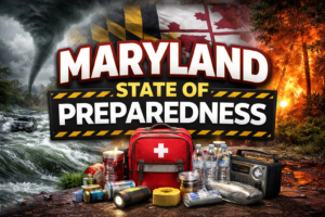
- Have an emergency kit ready and a family emergency plan in place, including where to shelter if a tornado warning is issued for your area.
- Heed all warnings and stay indoors during severe weather, including pets.
- Keep devices charged in case of power outages.
- Know who to contact in the case of a power outage. Emergency phone numbers for utility companies can be found at mdem.maryland.gov.
- Only use generators outdoors and never in a garage. The generator should be at least 20 feet away from the home and away from windows, doors, and vents.
For the latest information, please visit weather.gov/lwx. To receive alerts, tips, and resources related to threats and hazards affecting or that may affect Maryland, text MdReady to 211-631 or text MdListo for Spanish.

