 The Maryland Department of Transportation State Highway Administration (MDOT SHA) is proactively working to prepare for severe weather as remnants from Tropical Storm Ida hit Maryland.
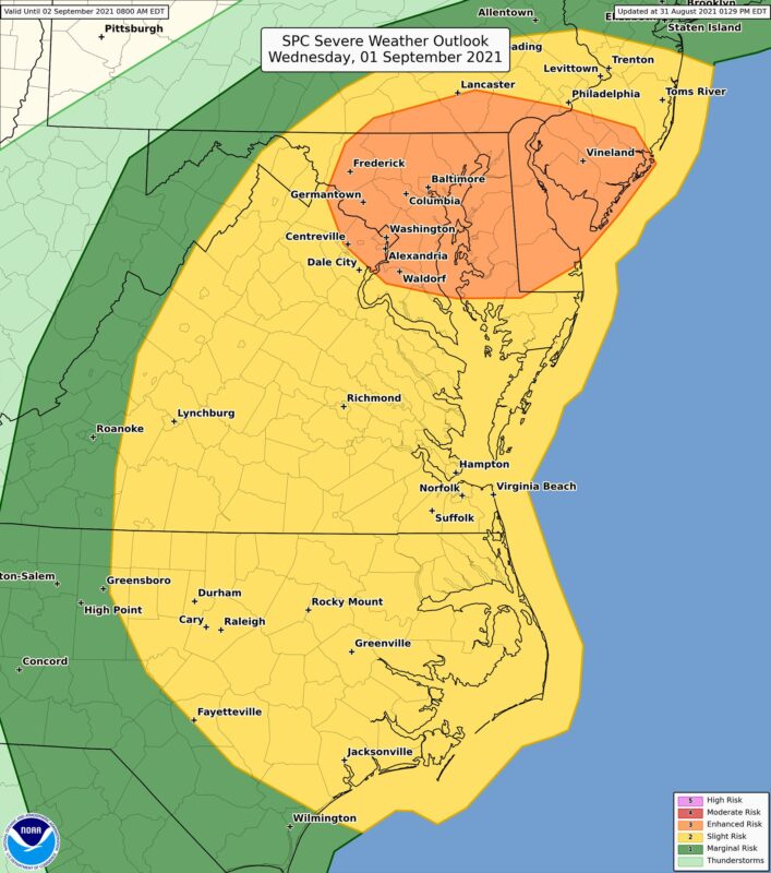
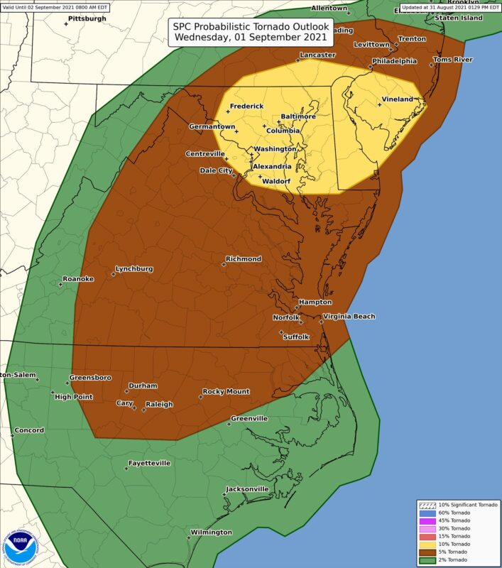
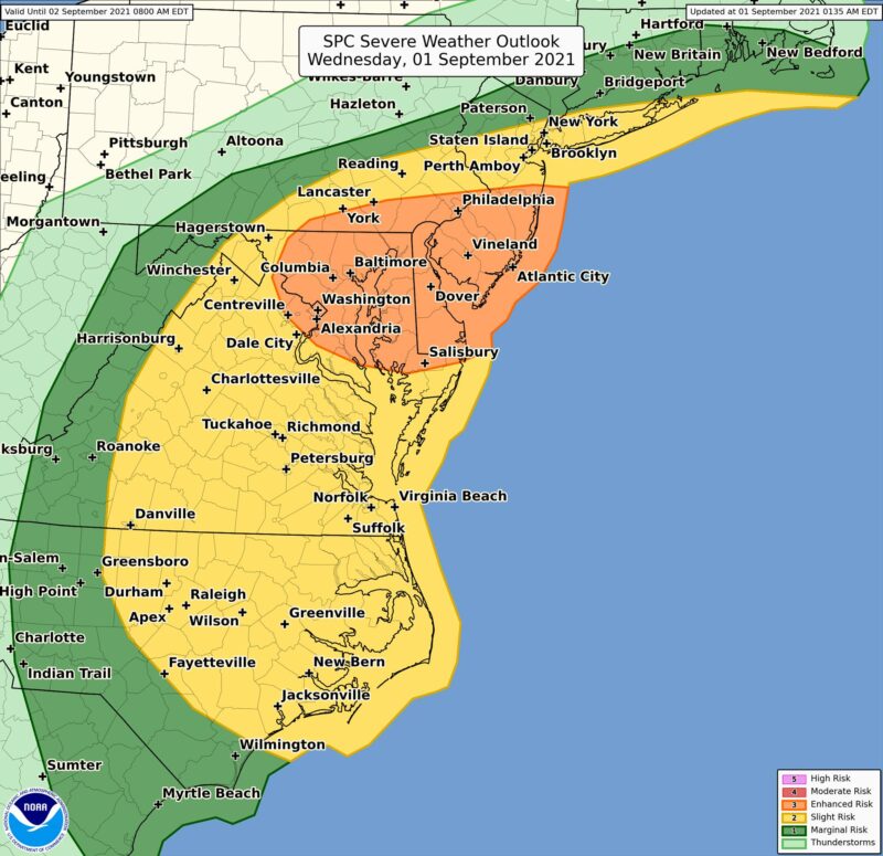
The National Weather Service is forecasting as much as six inches of rain in western parts of the state beginning around midnight. Heavy rain will gradually push its way eastward on Wednesday before tapering off from west to east Wednesday night into early Thursday. Isolated tornadoes are possible as the weather system passes through the region on Wednesday.
MDOT SHA crews started preparing yesterday by cleaning ditches, pipes, and inlets to ensure proper drainage, as highways could be affected by the heavy rain. Drivers are urged to look out for fallen trees/limbs and be prepared for scattered power outages
Crews at MDOT SHA maintenance facilities are evaluating all emergency response equipment such as high-water signs, chainsaws, chippers, loaders and trucks.
Additionally, crews are ensuring that we have adequate materials and supplies to keep the roadways safe and passable during and after the severe weather event.
Our Coordinated Highways Action Response Team, C.H.A.R.T Emergency Patrols will be out during the storm assisting with incidents and motorists . They will have units patrolling all areas of the State.
Motorists are reminded to move over a lane when approaching first responder vehicles or utility trucks working roadside or assisting other motorists. If not safe to move over, motorists must slow down when passing these vehicles.
MDOT SHA urges motorists to take the following precautions:
- Don’t drive through standing water. It only takes six inches of moving water to sweep a person off their feet, and 12 inches of moving water to move the average sedan. Remember “Turn Around, Don’t Drown.”
- Keep a close eye on local information sources for the latest weather conditions and plan accordingly.
- Delay trips during severe weather.
- Use low-beam headlights when windshield wipers are activated.
- Don’t try to move fallen tree branches as high-voltage wires may be intertwined.
- If power is out at a traffic signal, State law requires ALL drivers at the intersection to treat it as a four-way stop.
- In case of an emergency along interstate routes, drivers with cellular phones can dial #77 for roadside assistance.
Motorists are urged to monitor the forecast as threat levels can change throughout the day and visit md511.maryland.gov for real-time travel alerts and conditions.
The National Weather Service has placed Southern Maryland under a Flash Flood Watch, and Hazardous Weather Outlook until Thursday, September 2, 2021.
This Hazardous Weather Outlook is for the Maryland, Northern Virginia, and District of Columbia.
A Flash Flood Watch is in effect through tonight. Heavy tropical rainfall could result in considerable flash flooding. Flooding on mainstem rivers may then persist through the end of the week.
A Coastal Flood Watch is in effect for Anne Arundel County from Wednesday evening through Thursday morning. Scattered damaging wind gusts and a few tornadoes are possible with thunderstorms this afternoon and evening.
Periods of showers and thunderstorms with heavy rain are expected primarily this afternoon and evening. Rainfall amounts of 1 to 3 inches are expected, with localized amounts around 4 inches possible. * This amount of heavy rainfall will result in the potential for flash flooding of creeks and small streams, as well as the potential for river flooding on the main stem rivers.
![]()

