![]()
National Weather Service has posted a Hazardous Weather Outlook for Maryland portion of the Chesapeake Bay, Tidal Potomac River, and I-95 corridor through central Maryland, northern Virginia, and District of Columbia.
DAY ONE…Today, on Tuesday January 4, 2022, and tonight Cold temperatures tonight will cause any melted snow to refreeze on all untreated surfaces.
DAYS TWO THROUGH SEVEN…Wednesday through Monday There is a slight winter storm threat Wednesday morning. Light freezing rain or freezing drizzle is possible. Moderate tidal flooding is possible Wednesday. There is another slight winter storm threat Thursday night into Friday. Accumulating snow or a wintry mix is possible. If these threats materialize, they may cause travel disruptions. Gale-force winds are possible over the waters Friday.
Affected areas listed below
District of Columbia
Cecil County
Southern Baltimore
Prince Georges County
Anne Arundel County
Charles, St. Mary’s, and Calvert Counties
Central and Southeast Montgomery
Central and Southeast Howard
Southeast Harford
Prince William/Manassas/Manassas Park-Fairfax
Arlington/Falls Church/Alexandria
Stafford
Spotsylvania
King George
Chesapeake Bay north of Pooles Island MD
Chesapeake Bay from Pooles Island to Sandy Point MD
Chesapeake Bay from Sandy Point to North Beach MD
Chesapeake Bay from North Beach to Drum Point MD
Chesapeake Bay from Drum Point MD to Smith Point VA
Tidal Potomac from Key Bridge to Indian Head MD
Tidal Potomac from Indian Head to Cobb Island MD
Tidal Potomac from Cobb Island MD to Smith Point VA
Patapsco River including Baltimore Harbor
Chester River to Queenstown MD-Eastern Bay
Choptank River to Cambridge MD and the Little Choptank River
Patuxent River to Broomes Island MD
Tangier Sound and the inland waters surrounding Bloodsworth Island
St. Mary’s County officials posted the following.
The Department of Emergency Services urges travelers to stay off roads as much as possible. Wet spots on roads, bridges, overpasses and ramps have likely frozen and a strong potential for hazardous driving conditions exists. Black ice is a significant concern.
The National Weather Service says black ice is a deadly driving hazard defined as patchy ice on roadways or other transportation surfaces that cannot easily be seen. It is often clear (not white) with the black road surface visible underneath. It is most prevalent during the early morning hours, especially after snowmelt on the roadways has a chance to refreeze overnight when the temperature drops below freezing. Black ice can also form when roads are slick from rain and temperatures drop below freezing overnight.
If you must drive, allow plenty of extra time for travel and minimize any distractions while driving.
Calvert County Sheriff’s Office released the following.
If you have to travel, be sure to clear ALL snow and ice from your vehicle, including the roof and the hood. Take extra time on the road, slow down and leave plenty of space between your car and the car in front of you. Minimize distractions.
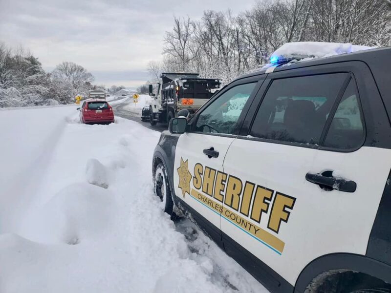
Charles County Officials and Sheriff’s Office released the following.
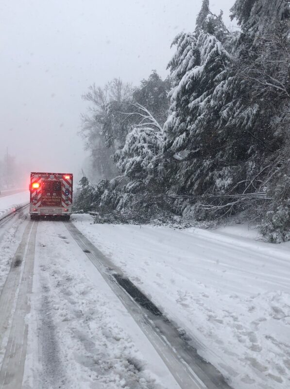
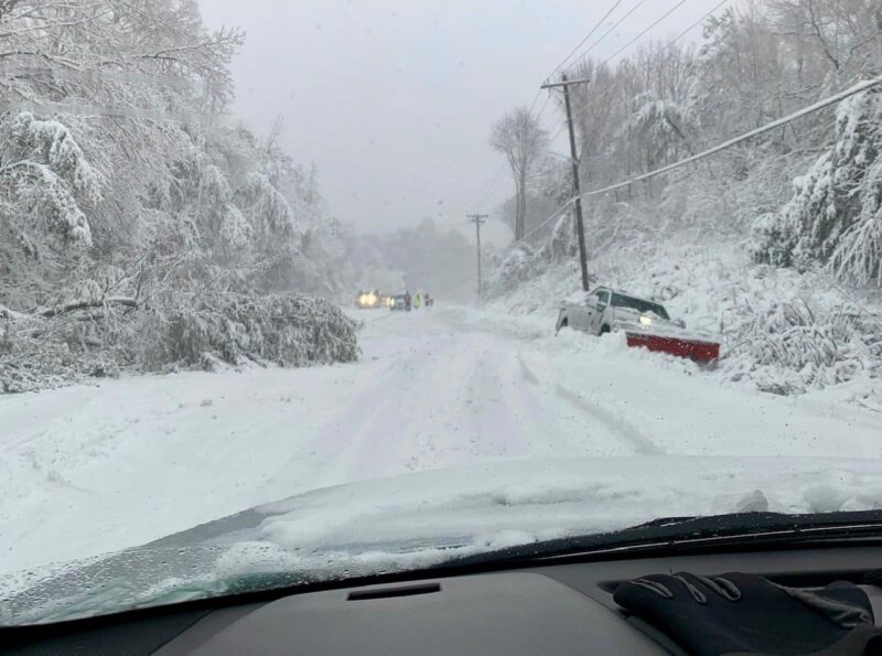
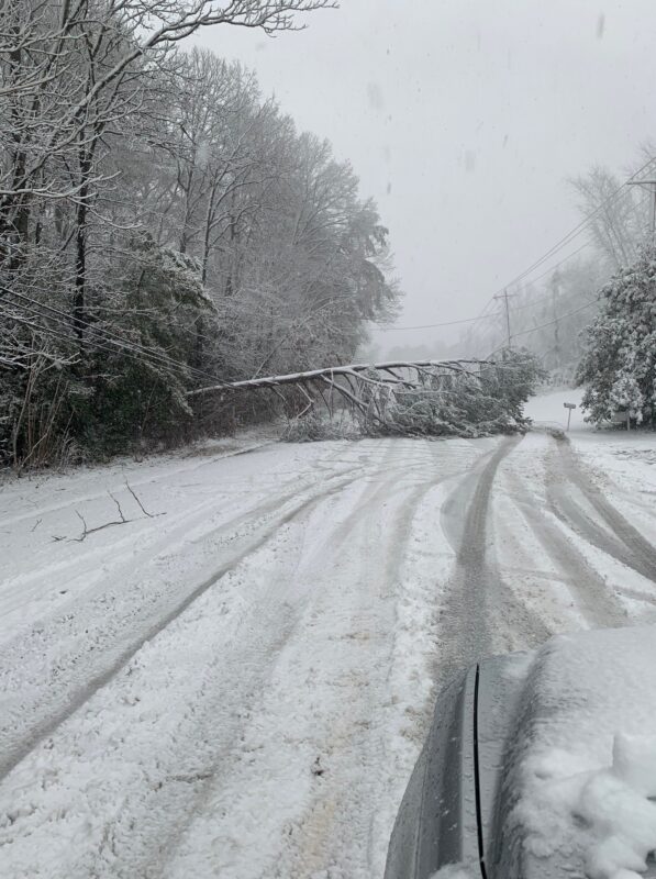
Good morning. If you are heading out today, please be careful of icy spots throughout secondary roads and a few main roads. Take precautions and be careful. There are some trees and wires down and abandoned cars on the sides of some roadways. Crews are still at work. Have a safe day!
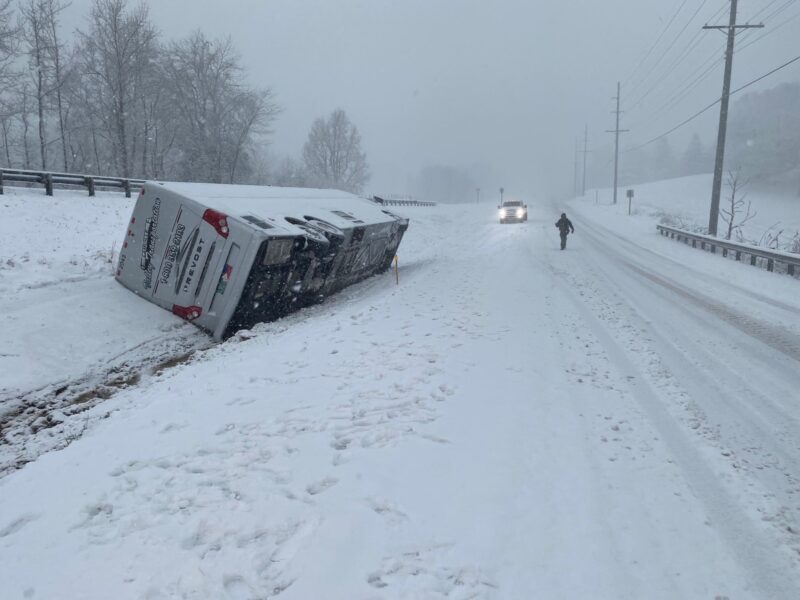
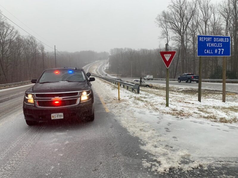
All photos below are taken Monday, January 3, 2022 in St. Mary’s, Charles, and Calvert County.