 Updates will be provided throughout the day on this article.
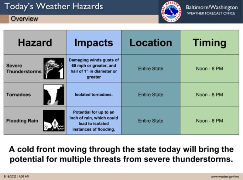
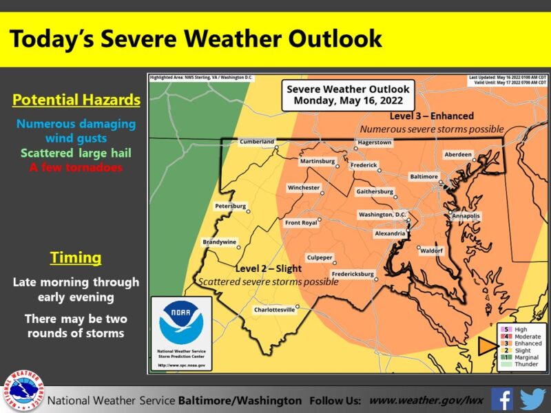
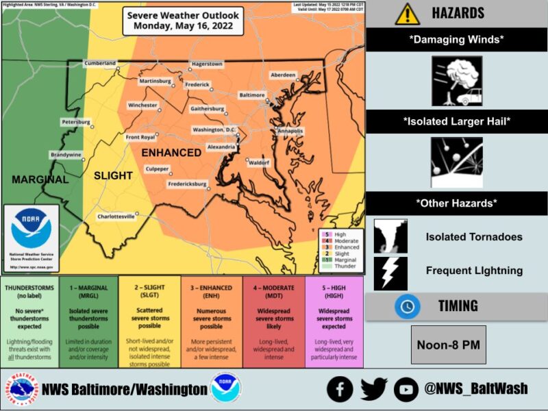
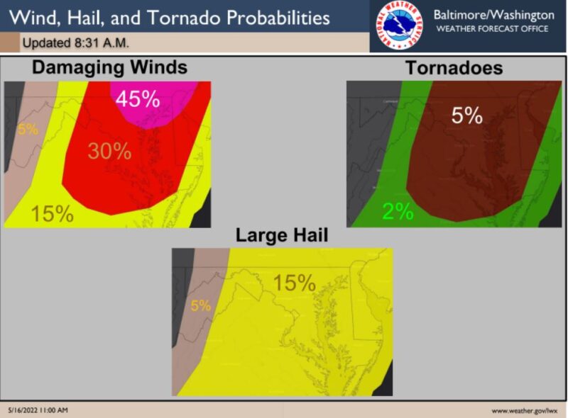
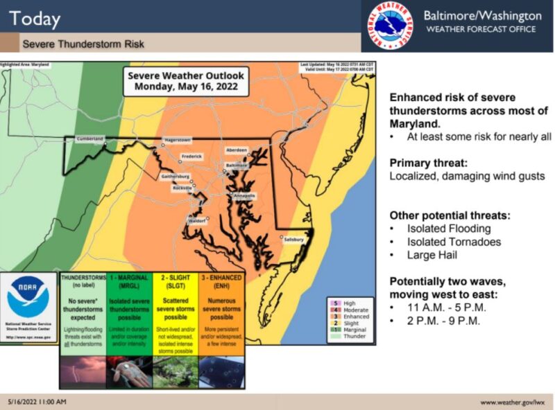
The risk of severe thunderstorms over much of our region today is ENHANCED (level 3 of 5). Damaging winds appear to be the primary threat, but hail, a few tornadoes, & flooding are also possible. Remain alert for rapidly changing weather conditions late this AM through the afternoon.
Today – Isolated showers and thunderstorms, then showers and possibly a thunderstorm after 2pm. Some of the storms could produce gusty winds. High near 82. Southwest wind 9 to 13 mph, with gusts as high as 22 mph. Chance of precipitation is 90%. New rainfall amounts between a quarter and half of an inch possible.
Tonight – Showers and possibly a thunderstorm before 8pm. Low around 57. West wind 6 to 8 mph, with gusts as high as 22 mph. Chance of precipitation is 80%. New precipitation amounts between a tenth and quarter of an inch, except higher amounts possible in thunderstorms.
This Hazardous Weather Outlook is for the Maryland portion of Chesapeake Bay north of Pooles Island MD-Chesapeake Bay from Pooles Island to Sandy Point MD-
Chesapeake Bay from Sandy Point to North Beach MD-Chesapeake Bay from North Beach to Drum Point MD-Chesapeake Bay from Drum Point MD to Smith Point VA-
Tidal Potomac from Key Bridge to Indian Head MD-Tidal Potomac from Indian Head to Cobb Island MD-Tidal Potomac from Cobb Island MD to Smith Point VA-
Patapsco River including Baltimore Harbor-Chester River to Queenstown MD-Eastern Bay-Choptank River to Cambridge MD and the Little Choptank River-
Patuxent River to Broomes Island MD-Tangier Sound and the inland waters surrounding Bloodsworth Island-District of Columbia-Cecil-Southern Baltimore-Prince Georges-Anne Arundel-Charles-St. Marys-Calvert.
Scattered to numerous severe thunderstorms are expected this afternoon and early evening. Damaging winds are the primary threat, but large hail and isolated tornadoes are possible as well. The best chance for severe storms will be between 2:00 p.m., and 7:00 p.m. An isolated instance of flooding is also possible.