 Hurricane Erin (2025) – Summary & Forecast: While direct impacts are unlikely, rough seas and rip currents are likely to the East Coast.
Current Status & Forecast Evolution
Rapid Intensification: Hurricane Erin began as Tropical Storm Erin on August 11, strengthened swiftly, and became the first major hurricane (Category 5) of the 2025 Atlantic season.
It peaked with sustained winds around 160 mph and a central pressure near 915 mb. A rapid eyewall replacement cycle then led to temporary weakening to Category 3, before restrengthening to Category 4.
Track Outlook: Currently moving west-northwest, Erin is expected to turn northward and remain offshore. Forecast tracks consistently suggest it will stay over open water and not make direct landfall on the U.S. East Coast
Coastal & Beach Threats – Despite no landfall, dangerous surf and rip currents are expected to impact beaches along the U.S. East Coast—from Florida up through New England. Evacuations have been ordered in vulnerable areas like Hatteras Island, North Carolina, due to threat of coastal erosion and localized flooding.
Damage & Impacts So Far – Cape Verde: Erin’s precursor has sadly caused historic flooding across the Cabo Verde islands, particularly on São Vicente, resulting in at least nine fatalities, 5 missing, and over 1,500 displaced. In the Caribbean, including Puerto Rico and the Virgin Islands, Erin’s outer bands have already delivered heavy rainfall (up to 9 inches), power outages, and flash flooding.
Preparing for Hurricanes – Hurricane Hazards. While hurricanes pose the greatest threat to life and property, tropical storms and depression also can be devastating. The primary hazards from tropical cyclones (which include tropical depressions, tropical storms, and hurricanes) are storm surge flooding, inland flooding from heavy rains, destructive winds, tornadoes, and high surf and rip currents.
Storm surge is the abnormal rise of water generated by a storm’s winds. This hazard is historically the leading cause of hurricane related deaths in the United States. Storm surge and large battering waves can result in large loss of life and cause massive destruction along the coast. Storm surge can travel several miles inland, especially along bays, rivers, and estuaries.
- Know your zone: Do you live near the Gulf or Atlantic Coasts? Find out if you live in a hurricane evacuation area by contacting your local government/emergency management office or by checking the evacuation site website.
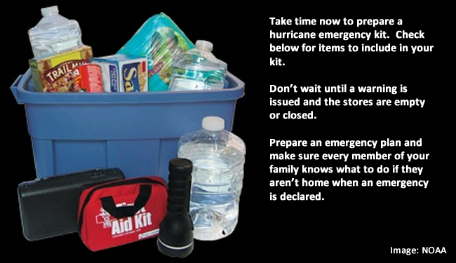
- Put Together an Emergency Kit: Put together a basic emergency. Check emergency equipment, such as flashlights, generators and storm shutters.
- Write or review your Family Emergency Plan: Before an emergency happens, sit down with your family or close friends and decide how you will get in contact with each other, where you will go, and what you will do in an emergency. Keep a copy of this plan in your emergency supplies kit or another safe place where you can access it in the event of a disaster. Start at the Ready.Gov emergency plan webpage.
- Review Your Insurance Policies: Review your insurance policies to ensure that you have adequate coverage for your home and personal property.
- Understand NWS forecast products, especially the meaning of NWS watches and warnings.
- Preparation tips for your home from the Federal Alliance for Safe Homes
In June of 2025, Forecasters within NOAA’s National Weather Service predict above-normal hurricane activity in the Atlantic basin this year.
NOAA’s outlook for the 2025 Atlantic hurricane season, which goes from June 1 to November 30, predicts a 30% chance of a near-normal season, a 60% chance of an above-normal season, and a 10% chance of a below-normal season.
The agency is forecasting a range of 13 to 19 total named storms (winds of 39 mph or higher). Of those, 6-10 are forecast to become hurricanes (winds of 74 mph or higher), including 3-5 major hurricanes (category 3, 4 or 5; with winds of 111 mph or higher). NOAA has a 70% confidence in these ranges.
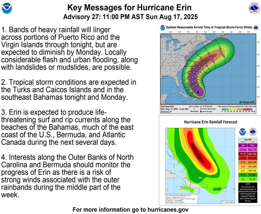
As of 1117 PM EDT Sun Aug 17 2025 – .SYNOPSIS…Major Hurricane Erin is near 22.3N 69.3W at 11 PM
EDT, and is moving northwest at 10 kt. Maximum sustained winds are 115 kt with gusts to 140 kt, and the minimum central pressure is 942 mb. Erin will move to 23.2N 70.2W Mon morning, 24.6N 71.3W Mon evening, 26.1N 72.1W Tue morning, 28.0N 72.8W Tue evening, 29.9N 73.1W Wed morning, and 32.0N 72.5W Wed evening.
Erin will change little in intensity as it moves near 36.5N 67.5W late Thu. Swells generated by Erin will continue to affect portions of the Virgin Islands, Puerto Rico, Hispaniola, and the Turks and Caicos Islands during the next couple of days. These swells will spread to the Bahamas, Bermuda, the east coast of the United States, and Atlantic Canada during the early and middle portions of the week.
These rough ocean conditions will likely cause life-threatening surf and rip currents. The pressure gradient between a ridge over the eastern U.S. and Erin will promote moderate to fresh N to NE winds offshore northern Florida to near 76W from early Tue through Wed. In the wake of Erin, high pressure will build west-southwestward along 24N through Thu night.