 UPDATE 2/22/2026 @ 6:45 A.M.: The National Weather Service has upgraded our winter storm watch to a Winter Storm Warning in effect from today, to Monday morning, for Portions of north central, northeast, and southern Maryland
WHAT…Heavy snow expected. Total snow accumulations between 5 and 10 inches. Locally higher amounts up to 14 inches are possible in northeast Maryland. Winds gusting as high as 35 mph. Eastern Shore, MD is under a Blizzard warning.
WHEN…From 3 PM this afternoon to 10 AM EST Monday.
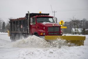
IMPACTS…Travel could be very difficult. The hazardous conditions could impact the Monday morning commute.
What JB Weather says! Follow him for more up to date and live updates by clicking here, and follow his page for notifications! – WHAT ABOUT MY BACKYARD? | POSTED: 2/22 6:30AM – Let’s take a deeper dive into our region. Southern Maryland and the Northern Neck will see rain transition to snow later this afternoon and evening as the coastal storm strengthens offshore. Snow becomes steadier tonight, with the best chance for accumulation after sunset as temperatures fall closer to freezing.
Most locations should pick up several inches of snow, with higher totals favored closer to the Bay and toward the Eastern Shore, where stronger bands may develop. This is why the Northern Neck along with Calvert, St. Mary’s, and Anne Arundel Counties are under a Winter Storm Warning, while Blizzard Warnings extend across the Eastern Shore, from Accomack to Queen Anne’s Counties, where winds will be strongest.
The biggest question overnight is how far west the heavier snow bands can push. If they set up along or just west of the Bay, totals could climb quickly in places like Calvert and Anne Arundel Counties. Farther inland, including Charles County and Fredericksburg, lighter amounts are more likely, though gusty winds could still reduce visibility at times where snow falls steadily.
PRECAUTIONARY/PREPAREDNESS ACTIONS…
Sunday – Rain before 4pm, then rain and snow. High near 39. Northeast wind 5 to 11 mph, with gusts as high as 18 mph. Chance of precipitation is 100%. Total daytime snow accumulation of less than one inch possible.
Tonight – Snow. The snow could be heavy at times. Low around 31. Blustery, with a north wind 17 to 21 mph, with gusts as high as 36 mph. Chance of precipitation is 100%. New snow accumulation of 4 to 8 inches possible.
Monday – Snow likely, mainly before 1pm. Cloudy, with a high near 40. Breezy, with a northwest wind 18 to 21 mph, with gusts as high as 36 mph. Chance of precipitation is 60%. New snow accumulation of around an inch possible.
Monday Night – Mostly cloudy, then gradually becoming mostly clear, with a low around 23. Northwest wind 14 to 16 mph, with gusts as high as 26 mph.
Effective Saturday, February 21, 2026, a Winter Storm Watch has been issued for Anne Arundel, Central and Southeast Howard, Calvert, and St. Mary’s Counties, from Sunday, February 22nd to to Monday morning, February 23rd, 2026.
WHAT…Heavy snow possible. Total snow accumulations of 5 inches or more are possible. Winds could gust as high as 35 mph.
WHEN…From Sunday afternoon through Monday morning.
IMPACTS…Travel could be very difficult, especially Sunday night into Monday morning. The hazardous conditions could impact the Monday morning commute.
PRECAUTIONARY/PREPAREDNESS ACTIONS – Monitor the latest forecasts for updates on this situation.
Tonight – A chance of rain, mainly after 3am. Increasing clouds, with a low around 36. East wind around 5 mph becoming calm in the evening. Chance of precipitation is 40%.
Sunday – Rain before 1pm, then rain and snow. High near 39. Northeast wind 6 to 14 mph, with gusts as high as 22 mph. Chance of precipitation is 100%. New snow accumulation of less than a half inch possible.
Sunday Night – Snow. Low around 29. Blustery, with a northwest wind 15 to 20 mph, with gusts as high as 32 mph. Chance of precipitation is 100%. New snow accumulation of 3 to 7 inches possible.
Monday – Snow likely before 1pm, then a chance of rain and snow. Cloudy, with a high near 40. Breezy, with a northwest wind 17 to 20 mph, with gusts as high as 30 mph. Chance of precipitation is 70%. New snow accumulation of less than one inch possible.
Monday Night – Partly cloudy, with a low around 24.

